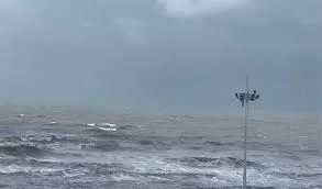
Chennai: The Cyclonic Storm Fengal, which crossed the coast between North Tamil Nadu and Puducherry coasts late last night, remained practically stationary in the same area after weakening into a Deep Depression and is expected to weaken further gradually.
The Met office has forecast more rains at least for the next two days in Chennai and its neghbouring districts, which were lashed by heavy rains yesterday.
In an udpate on Sunday evening, the Met office said the Cyclone Fengal over North coastal Tamil Nadu and Puducherry remained practically stationary during the past 12 hours and weakened into a deep depression.
It lay centered at 1130 hours of today, over the same region close to Puducherry, about 30 km north of Cuddalore, 40 km east of Villupuram and 120 km south-southwest of Chennai.
Forecasting its movement and intensity, the Met office said it is likely to move westwards very slowly and weaken gradually into depression over north coastal Tamil Nadu and Puducherry during the next 6 hours.
Forecasting moderate to very heavy rains till December three, it said scattered heavy to very heavy rain with extremely heavy rain at one
or two places is likely to occur over Villuppuram, Kallakuruchi,
Cuddalore districts and Puducherry, where a Red Alert was issued.
It said heavy to very heavy rain is likely to occur at a few places over
Chengalpattu, Kancheepuram, Tiruvannamalai, Dharmapuri, Salem,
Perambalur, Ariyalur, Thanjavur, Tiruvarur, Mayiladuthurai, Nagapattinam
districts and Karaikal area.
Heavy rain is also likely to occur at isolated places over Chennai,
Tiruvallur, Ranipet, Vellore, Tirupattur, Krishnagiri, Erode, Nilgiris,
Namakkal, Tiruchirapalli and Pudukkottai districts.
Tomorrow, heavy to very heavy rain is likely to occur at isolated places
over Nilgiris, Erode, Coimbatore, Tiruppur and Dindigul districts.
Heavy rain is also likely to occur at isolated places over Krishnagiri,
Dharmapuri, Salem, Namakkal, Tiruchirapalli, Karur, Madurai and
Theni districts.
On December three, heavy rain is likely to occur at isolated places
over Tirupattur, Krishnagiri, Dharmapuri, Salem, Namakkal, Karur,
Erode, Nilgiris, Coimbatore, Tiruppur, Dindigul and Theni districts.
It said strong winds with speed reaching 60-70 kmph and gusting
upto 80 kmph is likely to prevail over Villupuram, Tiruvannamalai,
Cuddalore, Kallakurichi, Ariyalur, Perambalur, Mayiladuthurai,
Namakkal, Salem and Tiruchirapalli districts and Puducherry.
Thereafter the wind speed is likely to gradually decrease and
reach 50-60 kmph speed.
It said very rough ro Rough Sea conditions is likely to prevail over
southwest Bay of Bengal, adjoining areas of westcentral Bay of
Bengal, and along and off North Tamil Nadu-Puducherry coasts,
and adjoining areas of westcentral Bay of Bengal, Gulf of Mannar,
along and off South Andhra Pradesh and North Sri Lanka coasts
till midnight of today, and will gradually improve thereafter.
The Met office advised total suspension of fishing operations over
southwest and adjoining westcentral Bay of Bengal and fishermen
are advised not venture into southwest Bay of Bengal adjoining
areas of westcentral Bay of Bengal, Gulf of Mannar and along
and off Tamil Nadu-Puducherry, South Andhra Pradesh and North
Sri Lanka coasts.
On Flash floods warning, it said the 24 hour outlook for the Flash
Flood Risk (FFR) is that moderate to High flash flood risk likely
over a few watersheds in Tamil Nadu and Puducherry– Chennai,
Tiruvallur, Vellore, Kanchipuram, Tiruvannamalai, Villupuram,
Puducherry, Cuddalore, Ariyalur, Perambalur and Karaikal districts.
Surface runoff/ Inundation may occur at some fully saturated soils
and low-lying areas over Area of Concern (AoC) due to expected
rainfall during the next 24 hours.
On damages expected over coastal and adjoining interior districts
of North Tamilnadu-Puducherry, it said rains would lead to localized
flooding of roads, water logging in low lying areas and closure of
underpasses mainly in urban areas of the above region.
There would be ocasional reduction in visibility due to heavy rainfall,
disruption of traffic in major cities due to water logging in roads leading
to increased travel time, minor damage to kutcha roads, damage to
horticulture and standing crops in some areas due to inundation,
partial disruption of power and communication lines and breaking of
tree branches, uprooting of small tress including banana, papaya and
drumstick.
For coastal districts of North Tamilnadu-Puducherry, the Met office
advised total suspension of fishing operations.
Fishermen out at sea are advised to return to coast and Surface
transport and shipping operations need to be regulated.
Onshore and offshore operation need to be regulated as per guideline,
Coastal hutment dwellers to be moved to safer places, people in
affected areas should remain indoors and avoid staying in vulnerable
structures.
In an advisory to the farmers, it suggested provision of adequate
drainage facilities for the removal of excess water from rice, cotton,
sugarcane, turmeric and vegetable fields, coconut and banana
orchards.
Provide mechanical support to banana plants to prevent lodging.,
make arrangements to drain out excess water from the standing
crop fields and fruit orchards, harvest the matured crops and keep
it in safe place and provide mechanical support to horticultural
crops and staking to vegetables.
UNI


